HIGH PEAK RAILWAY WALKS
(Update: June 2017) (May 2018).
HIGH PEAK JUNCTION TO HIGH PEAK GOODS
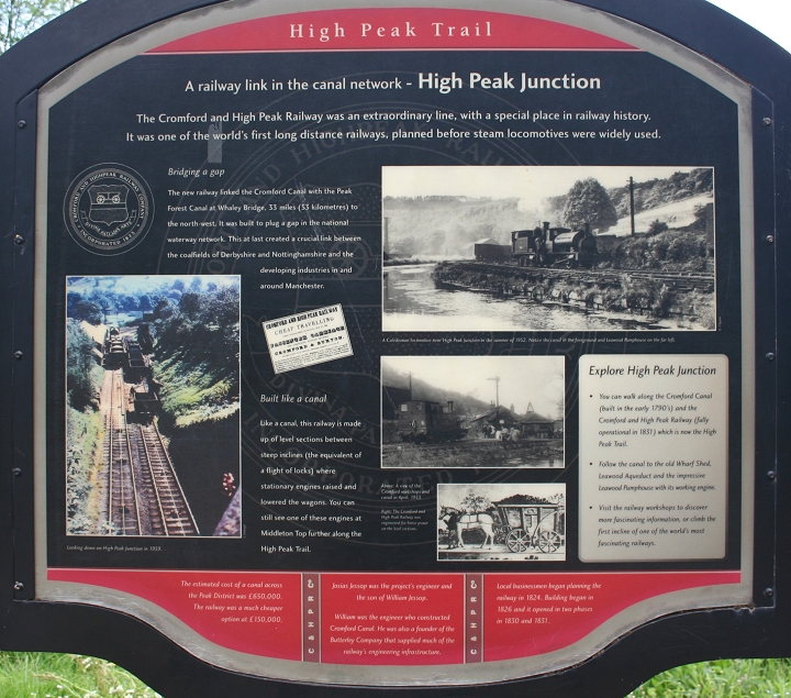
The High Peak Railway was built around 1827. There were nine Inclines in all. The first was at High Peak Junction Goods Yard up to Sheep
Pasture Top, with a level for three parts of a mile before climbing the Middleton Top Incline. Beyond Middleton Top was Hopton Incline
Parsley Hay was turned into the Tissington Trail and the Peak Junction to Parsley Hay via Middleton Top formed the High Peak Trail, used
by walkers, cyclists and Horse riders. It can get a bit muddy andthe heavily wooded areas remain wet even when otherwise dry and sunny.
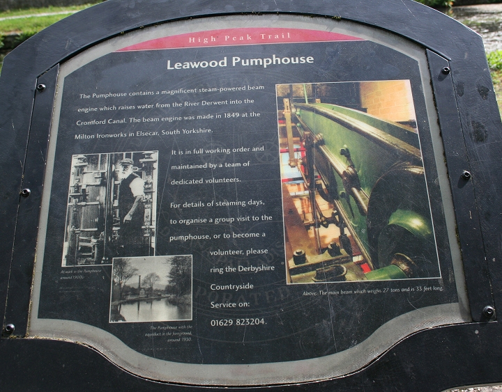
The engine house at Sheep Pastures is just a shell but the one at Middleton Top is fully preserved and the stationary engine is operated by air pressure fordemonstration. Off the railway but linked by the Cromford Canal railway/barge interchange at Wharf Depot Leawood engine is also in working condition and isran on a number of set days throughout the year, as at Middleton Top. You need to check when the engines are being operated.
The Peak District is naturally scenic with steep climbs up to 2000 feet, with fine limestone. The railway inclines are, 1 in 8 and 1 in 9 and should only be tackledif you know you can manage them and allow for slow progress over these sections. An easier way is to drive or take the bus to Middleton and walk back down theinclines, but of course, you need toget back up to Middleton afterwards.
I did the walks over two visits. On the first visit the skies opened up as I reached Sheep Pastures summit and had to give up and walk back down and back to Whatstandwell for my train home.
On the second visit I checked out the local buses and caught the No. 6.1 Derby to Matlock bus with a change at Wirksworth for Middleton. This is one of those strange services where the Derby bus doesn't stop at Middleton on the way to Matlock but does so on the way back! I had a 15-minute wait for the bus at Wirksworth, which added to the overall time of getting there. Just to add to the strange arrangement the Middleton bus is also number 6.1 but only runs between Wirksworth and Middleton. You need to ask for the bus stop Middleton Top, or Middleton Visitor's Center. There is a few minutes walk up a side road by the bus stop that takes you directly into the center. Unfortunately, the bus driver on this occasion got me wrong and took me well past this spot and dropped me off by the viaduct at Steeple Grange that gave me a walk up to the site of Sheephouse Station, where I could get onto the viaduct, which also meant that I had to walk up Middleton incline just to
get to where I planned to start from.
After a good look around Middleton Top and enjoying a bit of refreshment at the Visitor's Center I had a nice relaxed walk back down the two inclines over the 3 miles to High Peak Junction then from there the mile and three quarter canal side walk back to Whatstandwell station. Sadly, both days proved to be very dull and overcast but at least it didn't rain during my second visit. There are visitor centers at most of the main centers of interest such as at Hopton and Parsley Hay.
High Peak Junction (Whatstandwell) to High Peak Junction Goods Yard
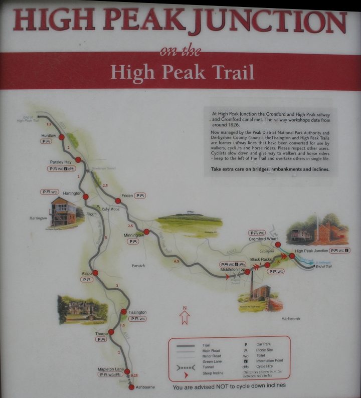
Official map showing the complete section from High peak Junction To Hurdlow with
the Tissington Trail joining at Parsley Hay.
My first walks.
My first walk started from Whatstandwell Station, which is on the Derby-Matlock branch line. There is an hourly train service, departing Derby
around 00.50 to the hour and back from Whatstandwell station around 00.46 to the hour.
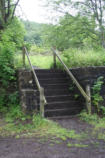
High Peak Junction is just over a mile from Whatstandwell. You join the track bed by walking along the A6 until you come to a wooden post
indication High Peak Junction and take the steep-ish walk down to track bed level. The path is in a heavily wooded area and can be quite messy
after rainfall. Suitable footwear is necessary and that includes for the whole trail over the summits, as well as walking the canal footpath from
Whatstandwell to the High Peak Junction site.
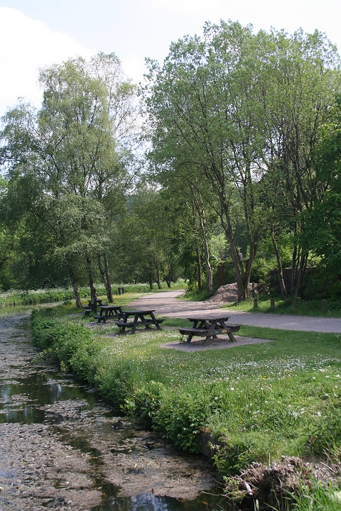
You join the canal footpath by walking from the station to the road junction by the Rising Sun pub, then up the hill for a few yards and the
opening is on your left. The road continues on to Crich village. The Canal walk is closer to two miles walk as it heads north of the railway for
some distance before meeting up with it again just before High Peak Goods Visitor Center.
You can drive directly to the Visitor's Center, where there is a car park or take the Derby-Matlock bus, which has an hourly service. For my
two visits to the High Peak I first went by train to Whatstandwell and on the second caught a bus from Derby to Middleton and walked back to
Whatstandwell over the High Peak trail. It is a round trip of approximately seven to eight miles altogether.
Yhe Memorial to the Sherwood Foresters at Crich. Below the tower is the site of the National Traway Museum.
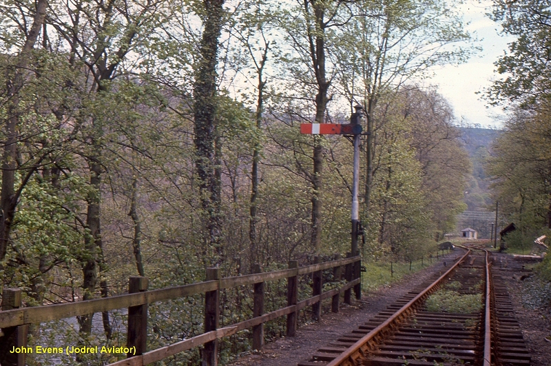
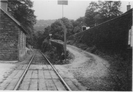
Lead up to High Peak Junction at closure. By John Evens.
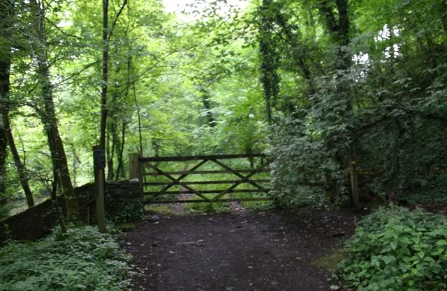
At the gated point with High Peak Junction, cut off from the public, just up ahead where it came off the main line.
The post on the right indicates the steep path down from the A6 where I joined this path.
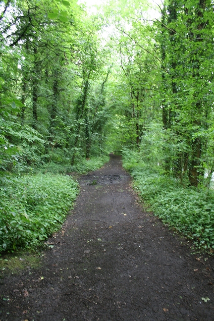
Left: Track bed looking towards the Wharf and visitor's center. Right: Track bed looking back towards High Peak Junction.
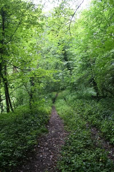
At this stage you do tend to wonder what you have got yourself in for. However, until you reach the Wharf this section is not part of the
official High peak Trail and has not been made up for public use.
Looking towards High Peak Goods Yard, the Wharf is just up ahead. As mentioned, this path can be very messy and
slippery as it was after the heavy rain of the previous day.
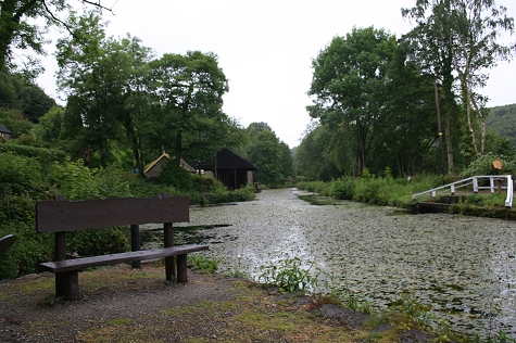
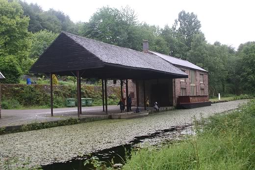
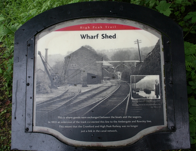
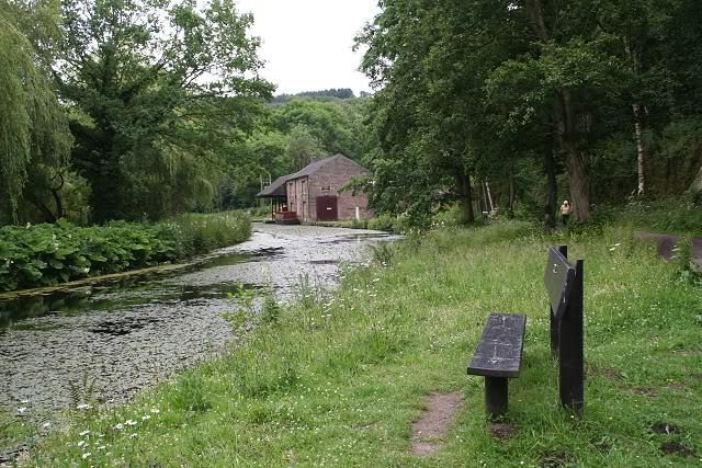
Left: Looking towards the Wharf where goods were exchanged. Seen just ahead (On the left). The canal walk is on the opposite side of the canal to the railway. The canal footpath
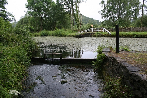
continues to Cromford. Right: The fenced off area on the right is where the water is pumped into the canal by the Leawood Engine. A sluice gate by the Leawood Pump House.
As this had no connection with the railway it will be covered in the web pages covering my walk along the canal.
 .
.
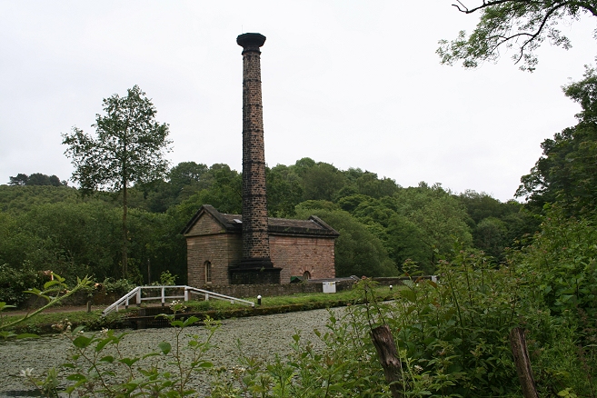
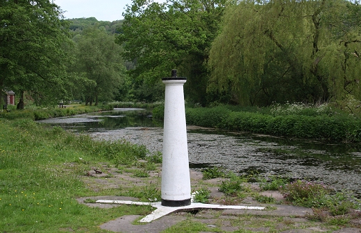
Leawood Pump House. From the railway side of the canal. It is open to the public on certain dates and the engine
fired up. It is a unequally large pump and well worth seeing in operation.
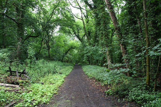
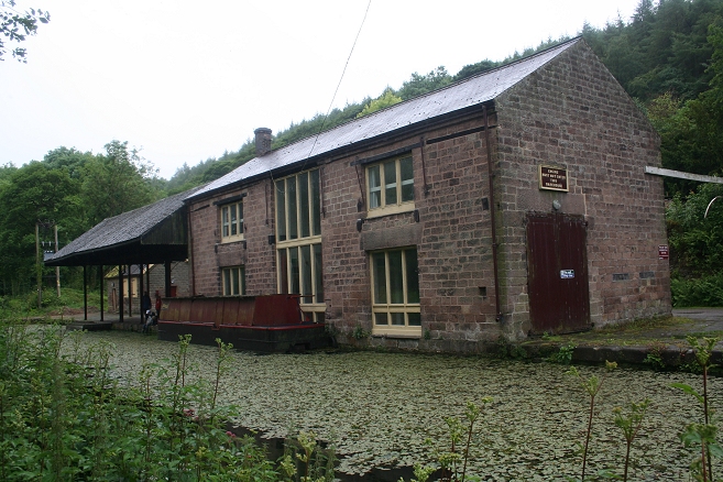
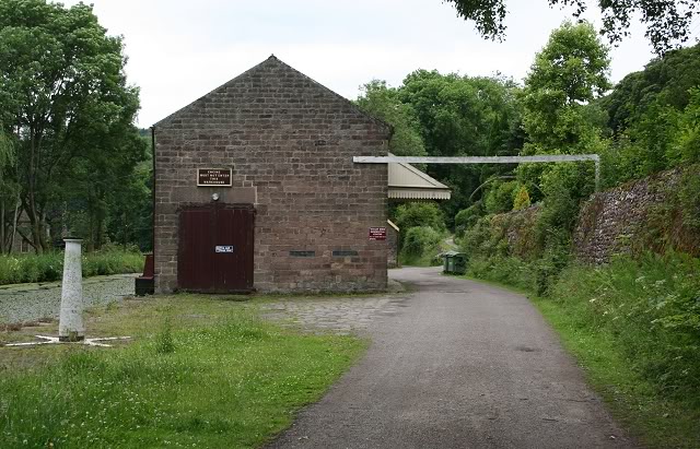
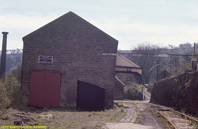
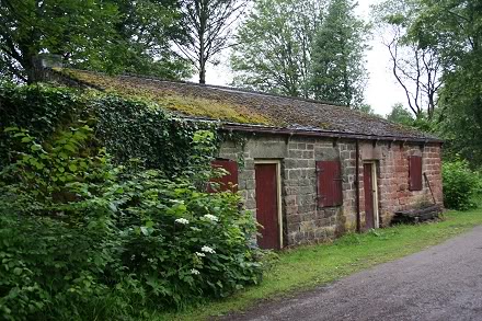
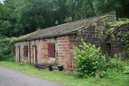
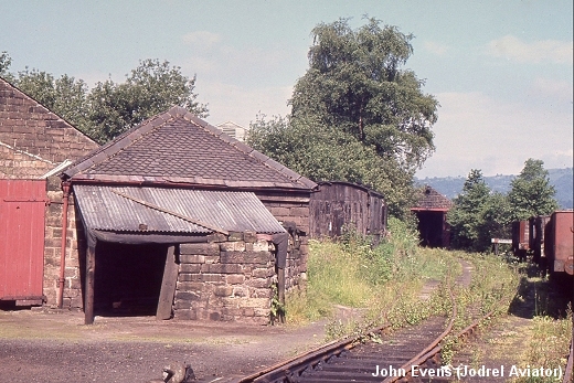
Left: First sighting of the railway Wharf and buildings, from the old track bed. Right: The original wagon height & width gauge and post still stand.
An outbuilding by the Wharf. The road on the right comes off the A6. The track bed to the right of the building is from High Peak Junction while the one on the left joins the canal
footpath from Whastandwell. Right: The scene in the 60's. (Author Unknown).
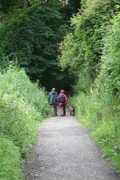
A couple and their dog walking on the High Peak Junction track bed
towards High Peak Junction.
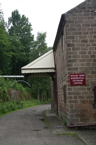
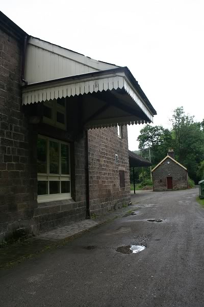
The Wharf building is now a residential outdoor center and used as a hostel.
The Wharf: Looking towards Cromford and from the opposite canal footpath
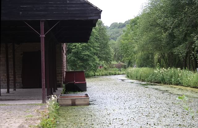
A tranquil scene compared to when the railway and canal were in full operation
View from the canal footpath
Along the High Peak Trail you will find posts with old photographs and details of the places of interest. Leawood Pumping
station is seen on the left behind the Crane. While a siding led up to and inside the shed locomotives were not allowed to
enter the building.
Approximately from the same spot as above. Leawood Pumphouse can just be spotted in the trees to the left.
Close to the same spot as above. By John Evens during the final days of the line.
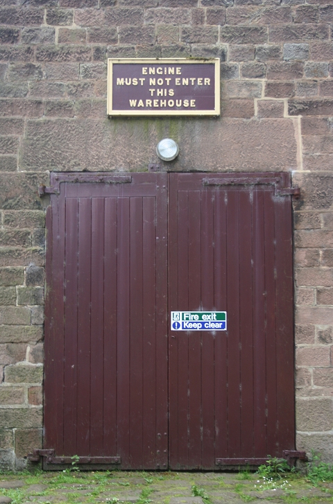
The original door and notice board

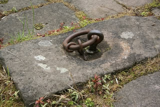
The Crane pinion, and arm holding ring
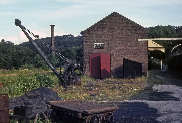
An excellent colour photo of the crane and shed in the 70's. (ColinChurcherFlickr)
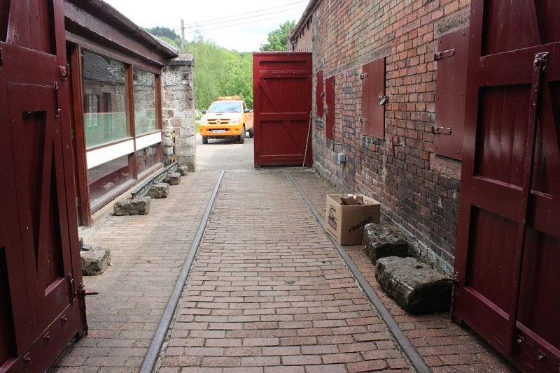
This well-built retaining wall. is holding up the A6. High Peak Junction Goods Yard is just up around the corner.
Trail Indicator.
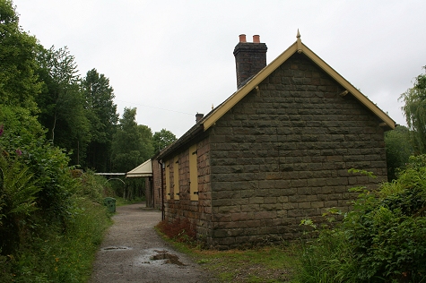
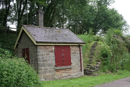
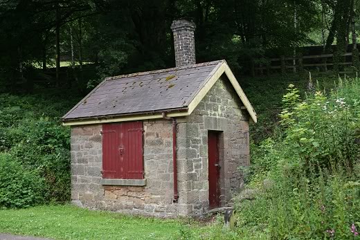
Ex Shunter's cabin
An old storage shed
Original Steps, leading up to the A6 entrance
Looking back to the Wharf depot
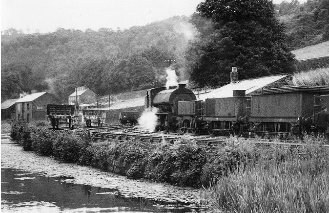
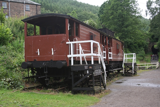
Left: The same spot as above but taken from the canal footpath on the opposite side. (Author Unknown). The water tenders were important as fresh water was short for locomotives and for drinking use. These
wagons were strategically placed over the length of the railway. Right: The sidings in the final days. By John Evens.
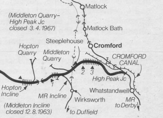
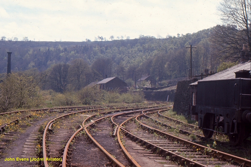
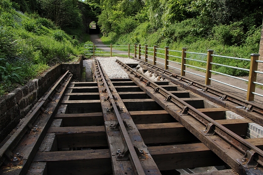
This map shows the line and gradients from Peak Junction Goods yard to Middleton Top. The distance is only two and a
half miles but you have to allow for the two long, gradients of 1 in 9 and 1 in 8.
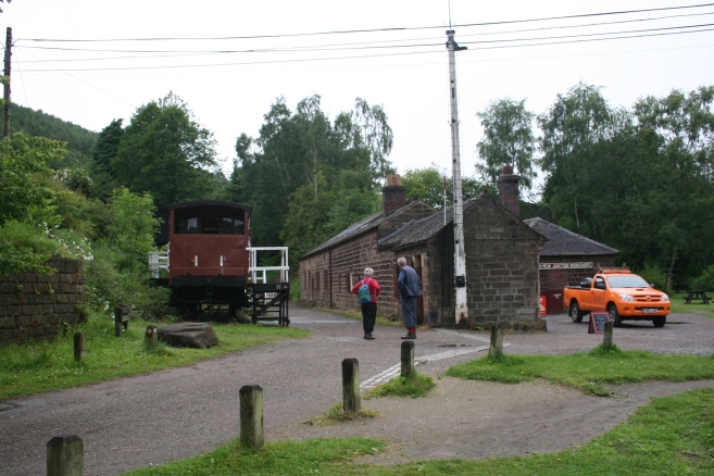
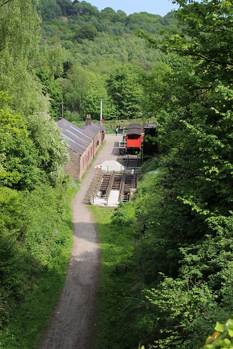
High Peak Goods Sidings now a picnic area.
Peak Junction Goods Yard, where the wagons would join and leave the incline. The Goods siding was on the right.
The branch too & from High Peak Junction came in on the left.
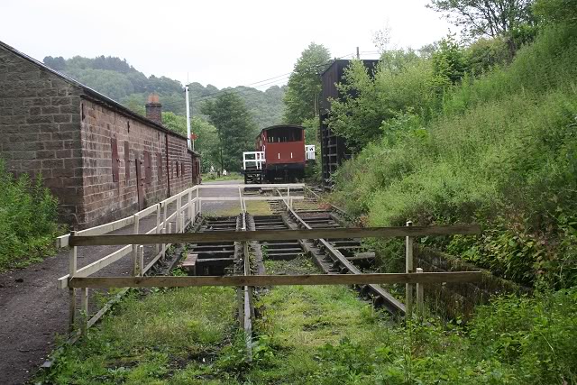
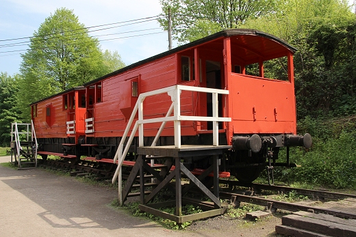
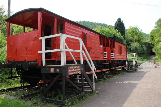
The Brake Vans are for display only. A small group get ready to tackle the incline.
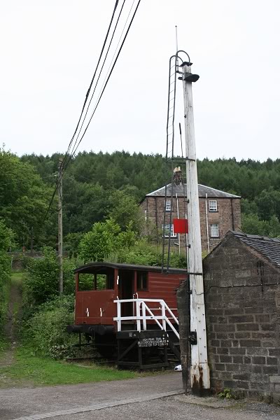
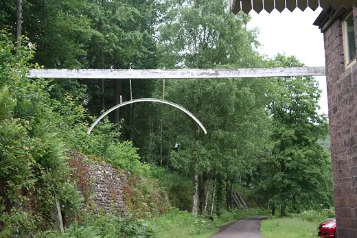
The incline control signal. Minus it's semaphore arm
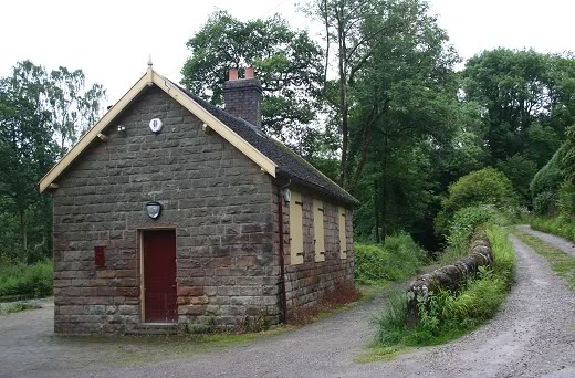
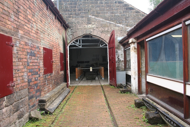
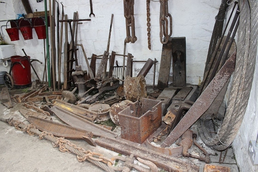
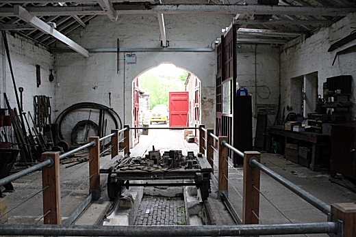
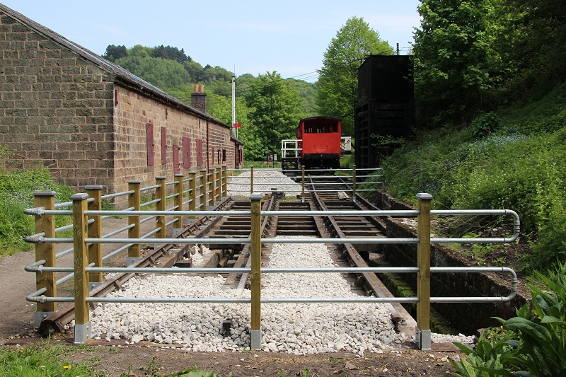
The workshops and Information center, which includes a shop, conveniences and a picnic area.
The original workshops are open to the public for a small payment, which includes a guide.
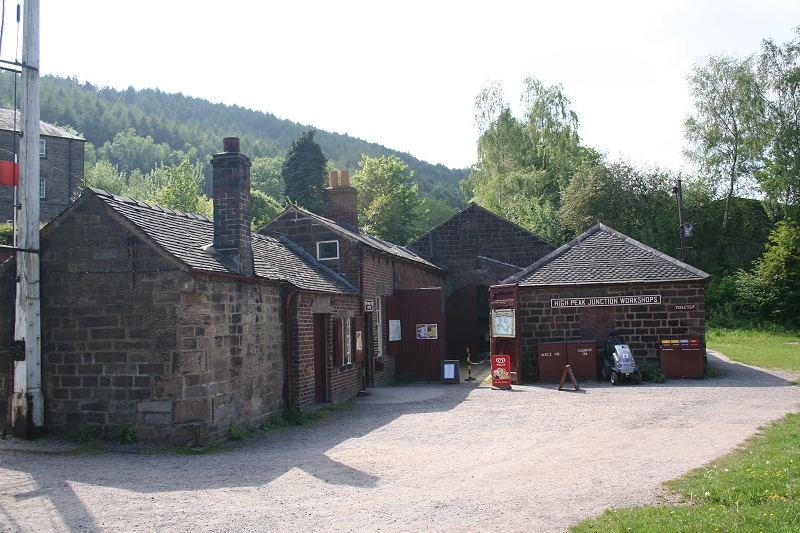
The information center/shop and the work shop.
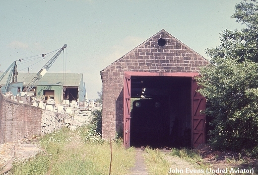
The building (above, Right) with the loco shed on the right. Right: High Peak Goods Loco Shed. Photos by John Evens
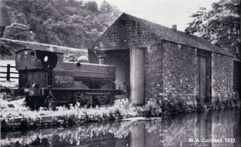
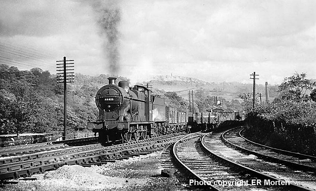
7859 on High Peak Goods Loco Depot in 1933. By W. A. Conwell.
=========================================================
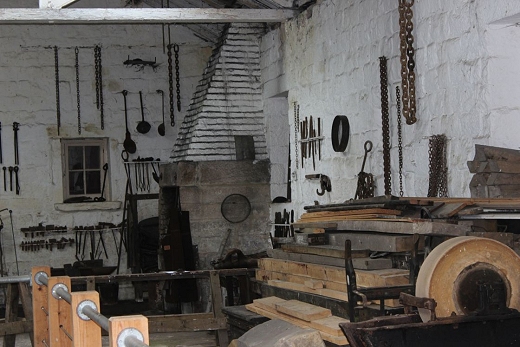
The workshop is complete with a servicing pit and many tools of the trade. It is well worth a visit.
New photos. 16th May 2016
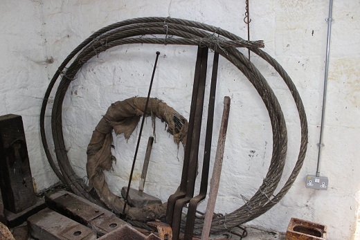
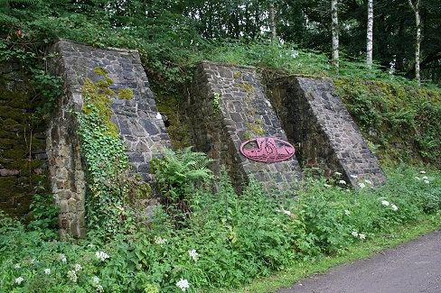
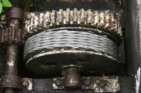
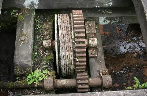
A Sample of the size of the Wire Rope used on the inclines.
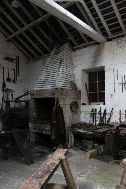
The furnace.
A model railway is on show in the building t the left.
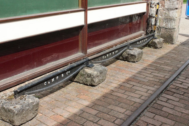
C&HPR Co. Fish-Belly Rails and individual stone sleepers.
=============================================================
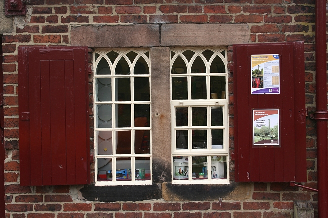
Nice ornamented windows. They matched the windows of the engine houses.
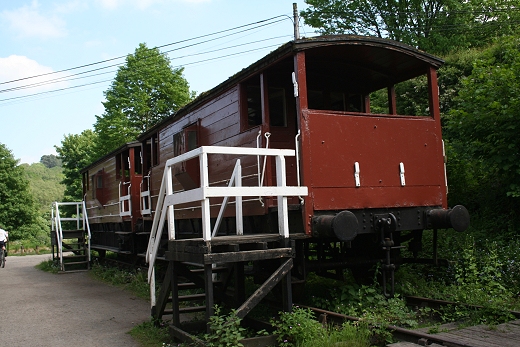
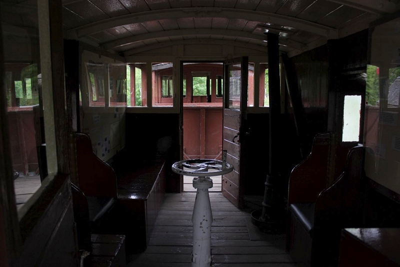
Brake van Interior. Added June 2016.
View from the brake van at the base of the incline. 16th May 2016.
 /
/
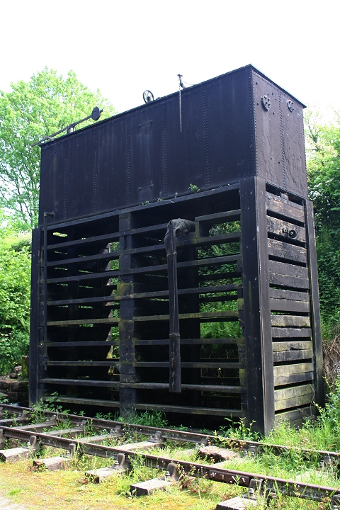
The loco water tower. 16th May 2016.
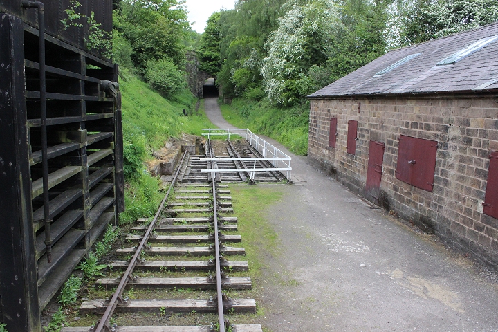
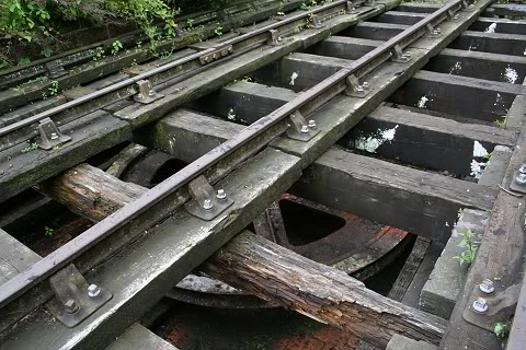
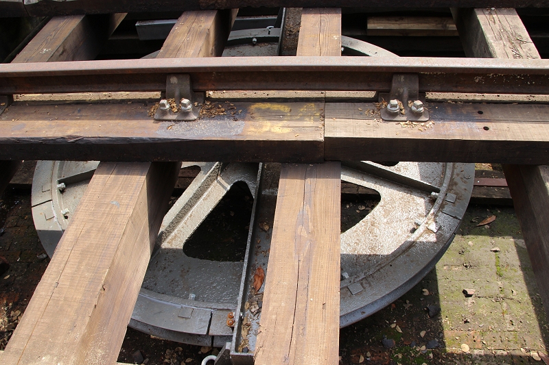
The Wheel Pit looking towards Peak Junction Goods siding. The control signal still stands but minus it semaphore arm
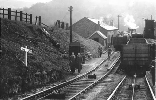
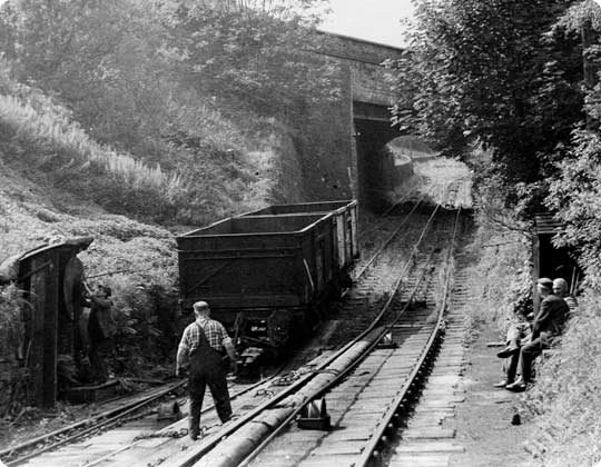
Around the same spot in the 60's (Author Unknown). The locomotive is probably waiting to take the
loaded wagons back to High Peak Junction and over the main line to their destination, having arrived
with the empty wagons earlier. It is interesting to see the pulling wire and the roller guides fixed in
the four foot.
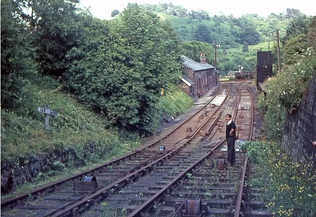
Another excellent colour photo of the bottom of the incline. You can also see the track leading
into the siding which today is the picnic area. (ColinChurcherFlickr).
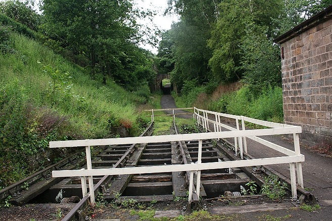
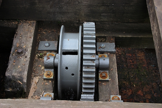
The wire Wheel Pit at the base of Sheep Pasture incline
I have since learned that these were Carriage Stabilizers. The metal strap kept the wagon couplings taught
while they dropped down the incline. I wasn't far off with my initial thinking that they were a braking
system of some sort.
0088.jpgThe large wheel that the wire was attached to from the Engine House at Sheep Pasture summit.
=====================================================================
UPDATE MAY 2018
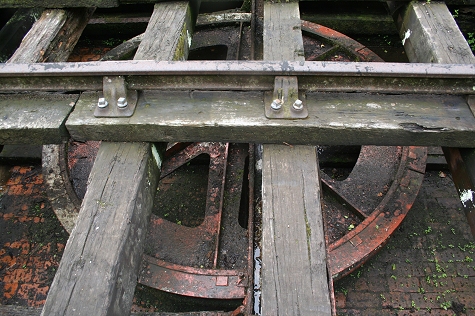
On my resent visit I found that the Wheel Pit was in progress of being freshened up.
A new set of railings that look much more permanant have been built around the wheel pit.
The wheel has been cleaned and given a fresh coat of paint as have the sleepers and the wooden wheel bracing posts have been renewed.
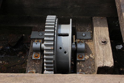
The two wire tentioners have also been cleaned up and painted.
The brake vans have been given a fresh coat of paint.
Te overall site looks much cleaner.
View from the A6 over bridge. Left: 1959. Right: May 2018.
==================================================================================
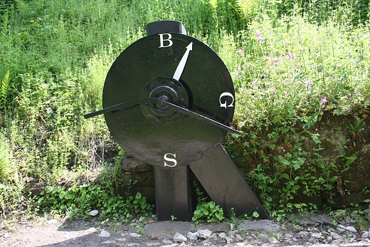
Lef: The wagon position indicator at Sheep Pasture Bottom. The indicator pointer was linked to the wire by a chain link.
Right: By the wagon position indicator. Someone is setting the indicator ready for the movement up the incline.
Compare the width of the over-bridge (below left) which has been strethened for the increasing A6 traffic.
(Author Unknown).
To: HIGH PEAK GOODS TO SHEEP PASTURE TOP
My Thanks To.....
John Neave for his kind permission to use a number of his 1960's photographs when the railway was still in operation. Check out John's ''Going Loco'', which includes a C&HPR history. At....
http://goingloco.neave.com/
Mark Norton for the use of 1940's photos by his late father Dennis J. Norton.
http://www.photobydjnorton.com/CHPR_Menu.html#Links
John Evens for the fantastic colour photos taken in April 1967 just prior to the line closing. John's photos can be viewed on Flickr under JodrelAviator.
Reading: "The Cromford & High Peak Railway" by John Marshall. Published by Martin Bairstow. Printed by The Amedeus Press 2011.
Other Railway Walks....
The Dundee & Newtyle Railway The first passenger railway in Scotland built in 1831, which had three inclines operated by stationary steam engines. The main source of income was from
the numerous stone quarries in the area and local farming produce. Passenger numbers were always sparse.
The inclines were abandoned in the mid 1800's by new deviations that allowed through locomotive running.
The line also included the Dundee Law (Hill) tunnel built at 300ft above the City. Both the north & south portals of the tunnel are buried below modern housing
schemes. Passenger services ended in 1955 and the line closed completely in the mid 60's.
Unlike the C&HPR none of the Engine houses were preserved. The inclines can still be followed but sections have been back-filled or ploughed over
This web site tries to cover as much as possible.
Boddam To Ellon Branchline Built by the GNSR in the latter part of the 20th century. The passenger service only lasted until 1934 but goods remained up to total closure in 1949.
The GNSR built a large Golf course and Hotel at Cruden Bay, with an electric tramway between the station and hotel. All that remains today is the Golf course.
Other web pages....
Kittybrewster Memories. Kittybrewster Loco Depot, Aberdeen.
Tivoli Memories The Tivoli Theatre, Aberdeen.
Hosted by www.theatreorgans.com
BACK TO HOME PAGE